
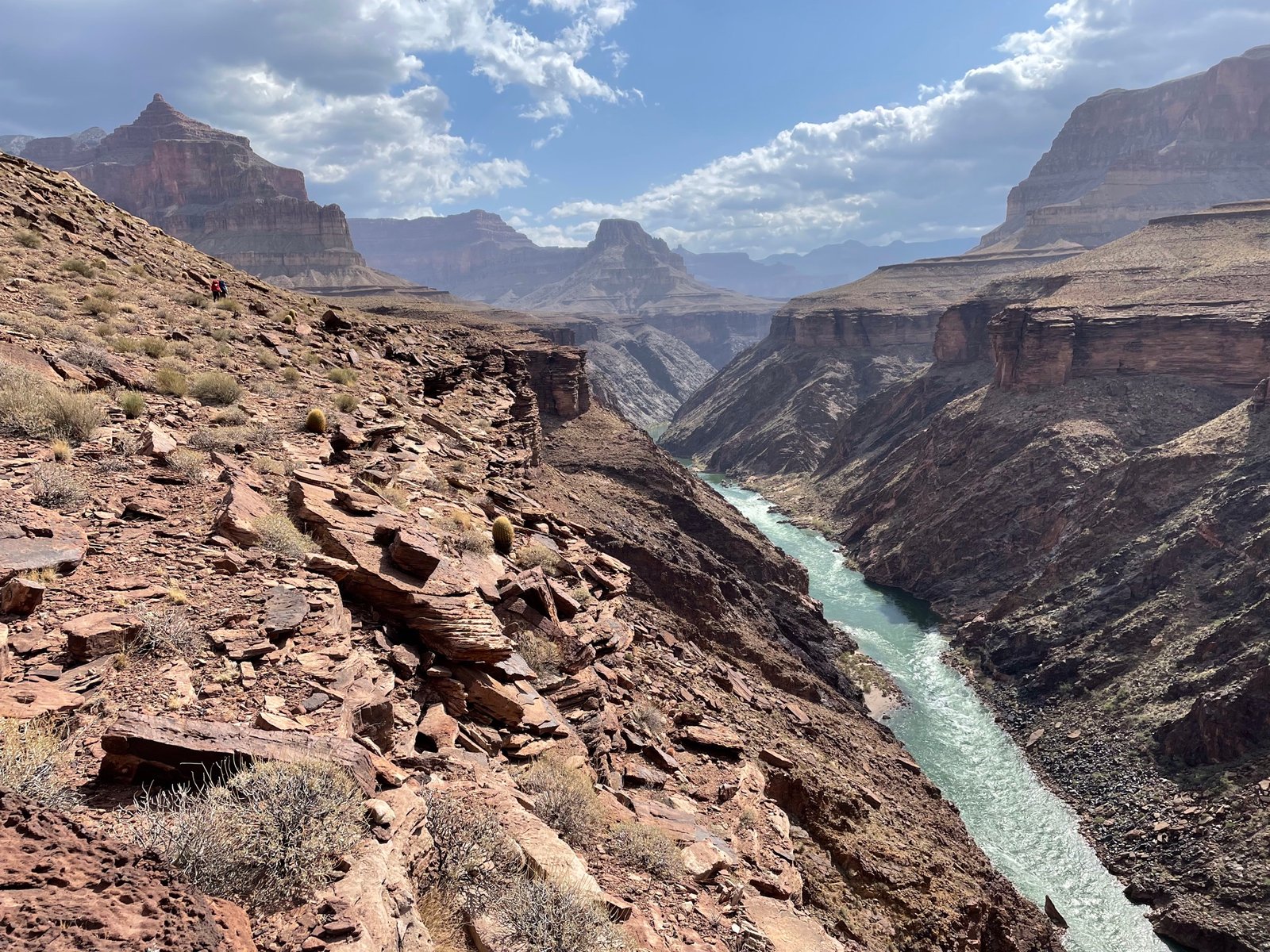
“We have an unknown distance yet to run, an unknown river to explore. What falls there are, we know not; what rocks beset the channel, we know not; what walls ride over the river, we know not. Ah, well! we may conjecture many things.” – John Wesley Powell
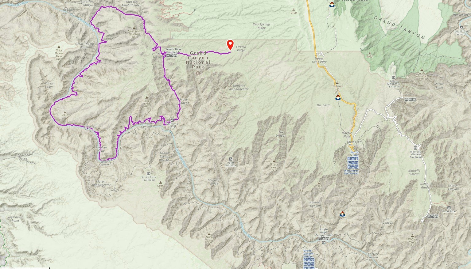
The Powell Plateau Circumambulation loop is a trek that only a handful have ever done. It’s approximately 65 miles (plus an additional 12 we had to add) and over 30,000 feet of elevation gain.
Day 0
“Spectacular achievement is always preceded by unspectacular preparation.” – Robert Schuller
On Sunday, April 24, three of us set out for the North Rim of the Grand Canyon. Lenny, Paul (PK) and Terri made the 11 hour drive from Evergreen, CO. Travel was easy, though we were aware that there may be snow and downed trees to deal with. The paved road to the North Rim wouldn’t open for another 3-4 weeks, so it meant driving 60 miles of dirt Forest Service roads to get there that hadn’t been maintained since last Fall.
Just after leaving the Forest Service boundary and entering into the National Park boundary (marked by an open gate), we were met by two rangers in a truck coming toward us. They told us we wouldn’t get very far due to downed trees. We told them it was fine, we had a saw and axe. Well, shortly after, we encountered the first tree. The guys went to work, cutting out a section, and, after about an hour, we were heading down the road again.
They didn’t know how determined we were
Rolling the cut section of tree out of the way, we happily drove past, blissfully unaware that there were many more downed trees to come. At about 6 miles out from the trailhead, we could go no further and camped there for the night knowing we’d have to cover those 6 miles before we even started our loop. We ran into a guy on a mountain bike who leads veteran volunteers to clear roads like these. He said he’d have it cleared in the next couple days.

Couldn’t drive in any further so we camped for the night
Day 1
“The only difference between fear and excitement is your attitude about it.” – Rakshana
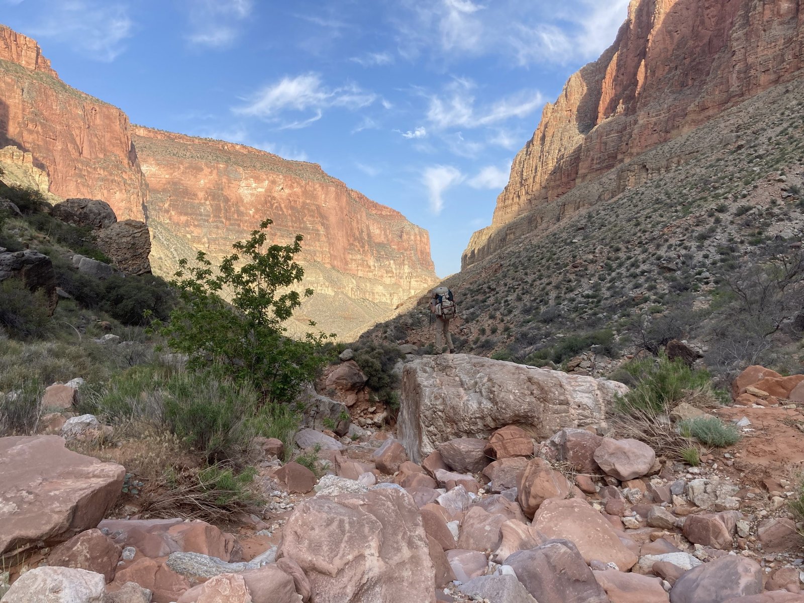
We were up and off before 7am, hiking the 6 miles to the trailhead in order to start the official journey. It was a beautiful morning in a beautiful forest and we were at the trailhead in just a couple hours.

Official start photo – clean clothes, happy faces
The route starts with about 3/4 mile of the North Bass trail until you hit the Mauv Saddle and Teddy’s Cabin. Although Teddy never actually stayed there, he did visit the area to hunt. Regardless, it’s a pretty cool cabin.
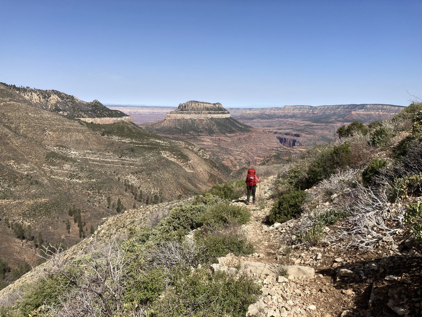
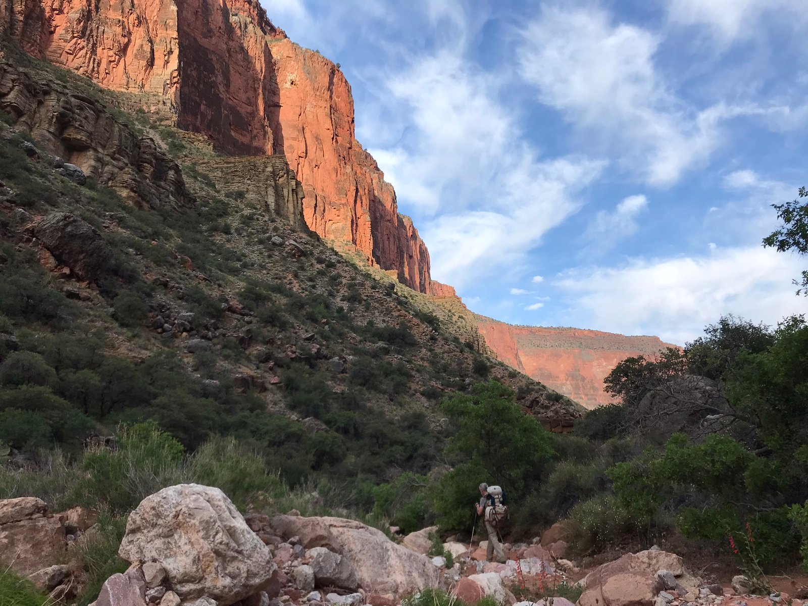
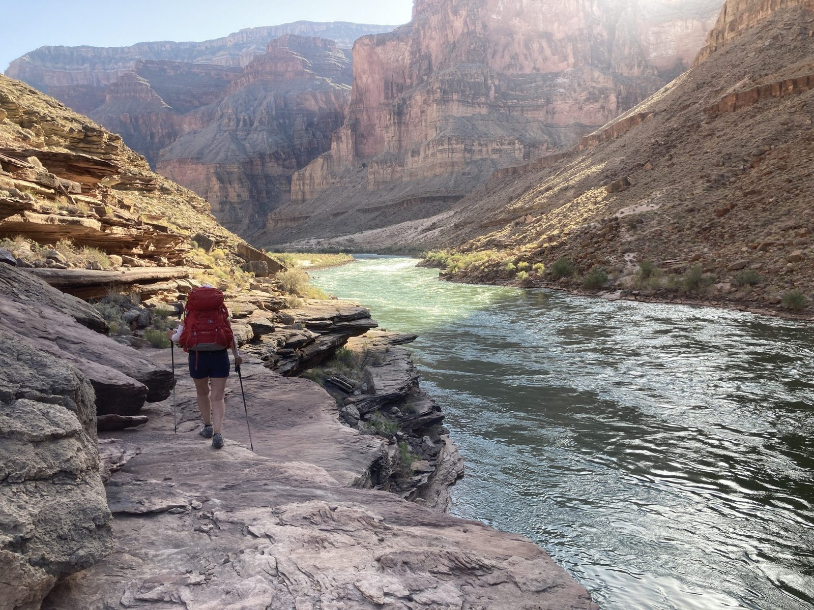
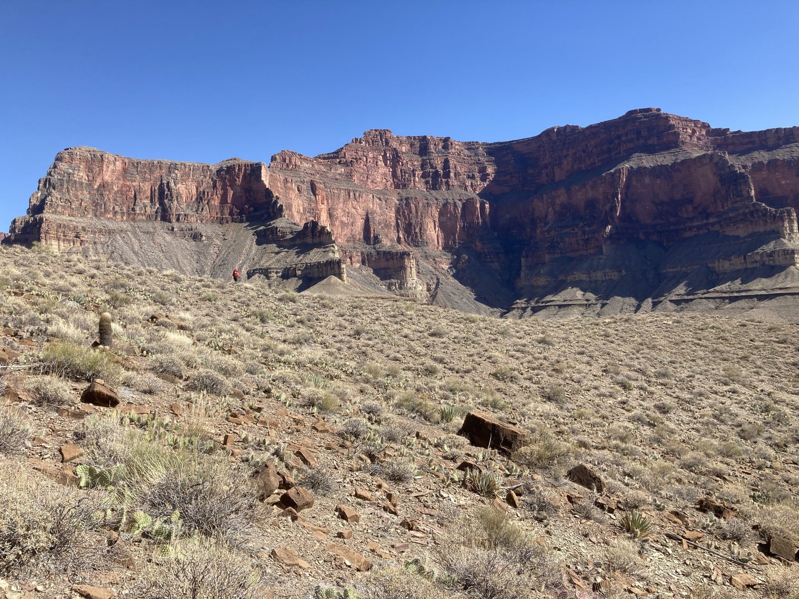
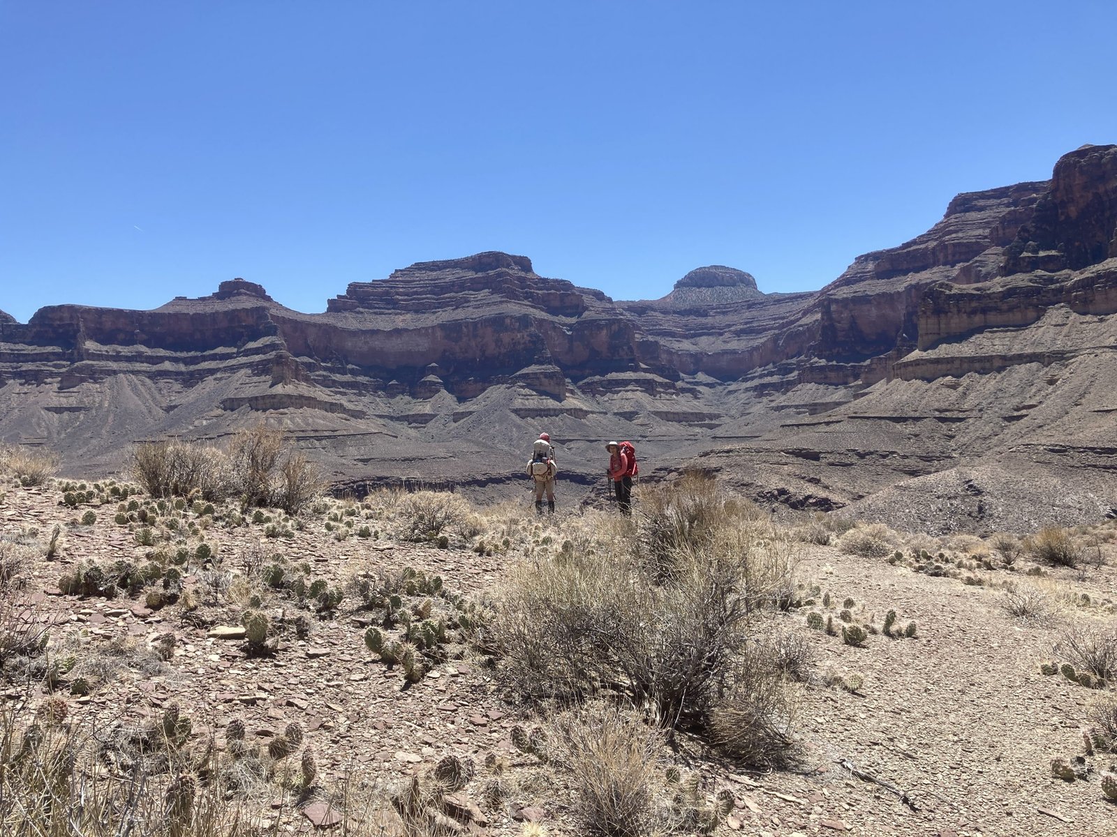
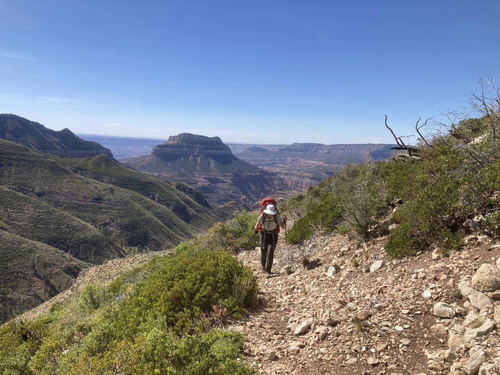
Off we go, down to the saddle on the bottom left and down the canyon floor below to the northwest and around to the west
Teddy’s Cabin
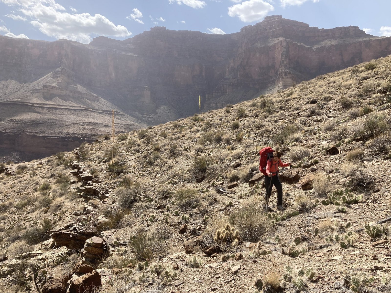
From the cabin north, there is no trail — only brush — lots of brush and lots of bushwhacking. For miles. And miles.
Bushwhacking tips: Wear pants and close your eyes
There were a couple scrambling pour-offs and then a bypass to the west. After reaching the nose of the bypass, for some odd reason, we kept going around the hill to the head of the side canyon instead of directly down the nose. This took an extra two hours (plus another hour the next day) and most of my nerves for the day. That, coupled with our extra six miles, put an end to our day and we made camp on a small bare patch. Not the intended plan.
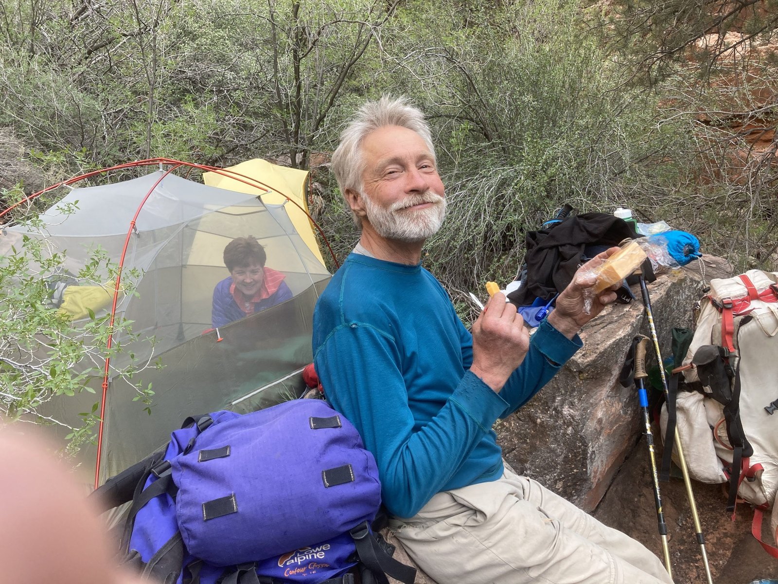
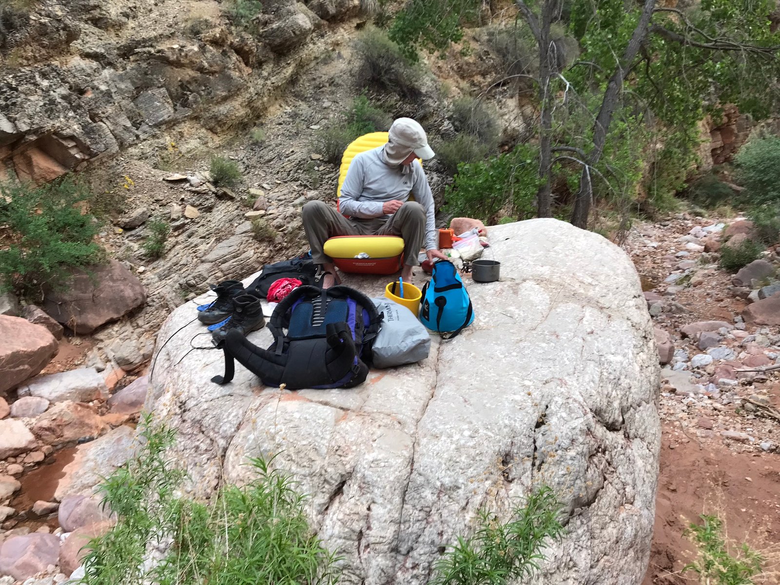
PK holding one of the four pounds of cheese he carried in his backpack (he’s from Wisconsin)
Day 2
“Possible ideas and thoughts are vast in number. A distinct word for every distinct idea and thought would require a vast vocabulary. The problem in language is to express many ideas and thoughts with comparatively few words.” – John Wesley Powell
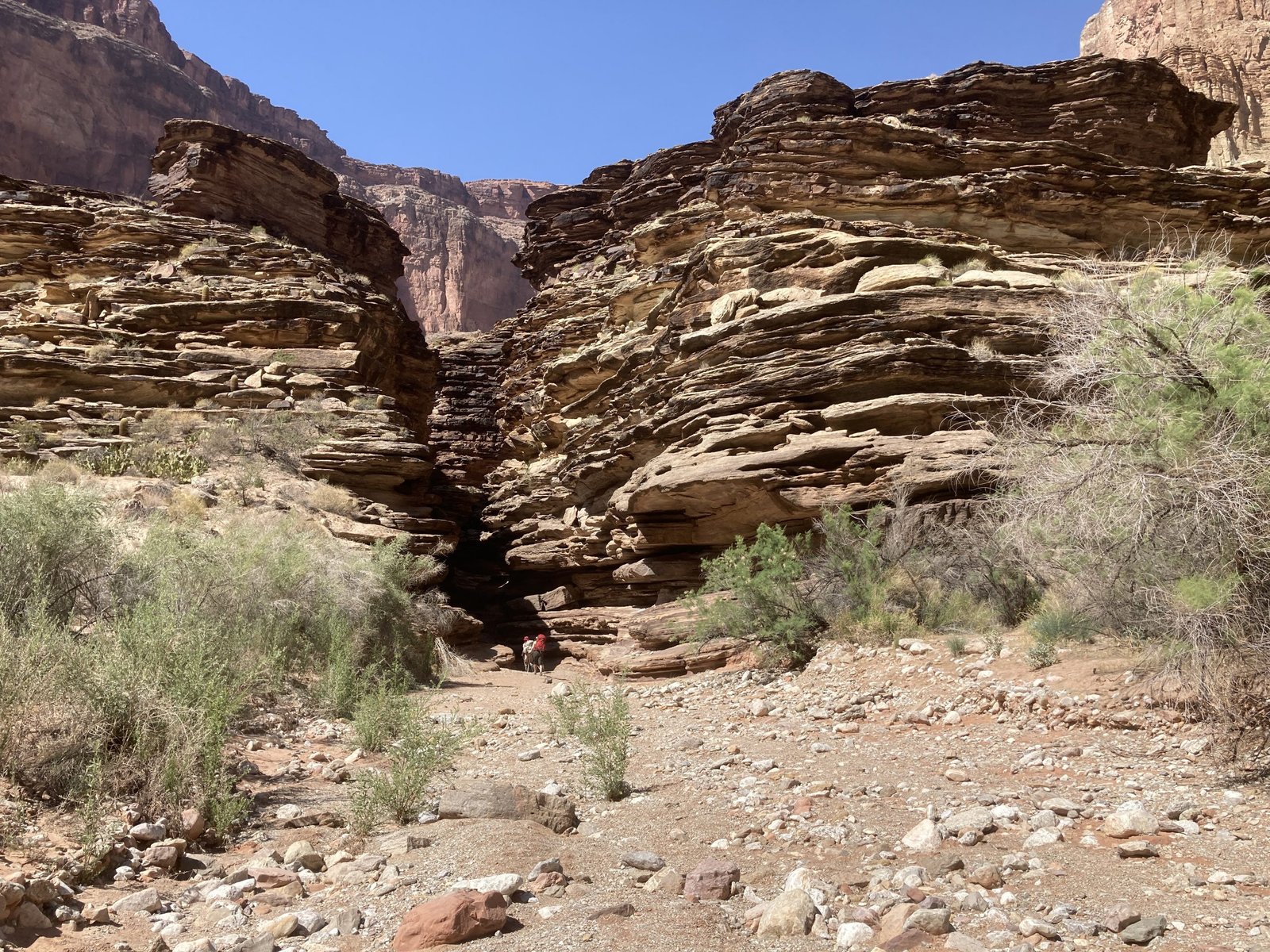
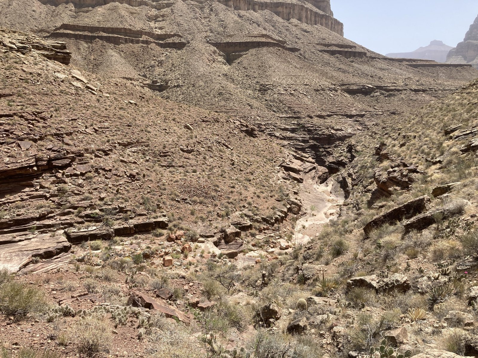
After hour of unplanned bushwhacking, we were back in the Saddle Canyon drainage. Most days, we would hike for an hour or so until we found a nice place to sit for a rest and breakfast. We found that on this morning at the top of our first scramble-down.
At this point, there was less bushwhacking and more down-climbing. Nothing too hard or scary. And it helps to go with two, very experienced climbers who brought a rope.
Some fun times in questionable pools kept it interesting during the second half of the canyon. But, also some pretty slickrock places.
At last you reach the famous “slicky-slide.” It’s a long, steep, and potentially slippery chute that you must go down. Most don’t have a rope, which I can’t imagine. Fortunately, we did.
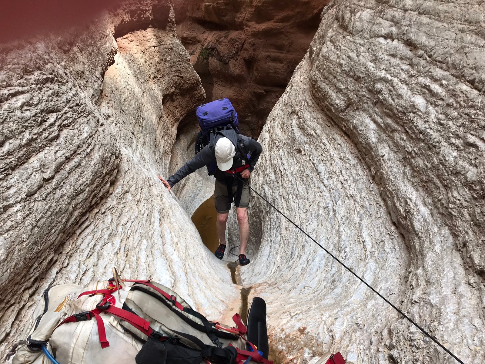
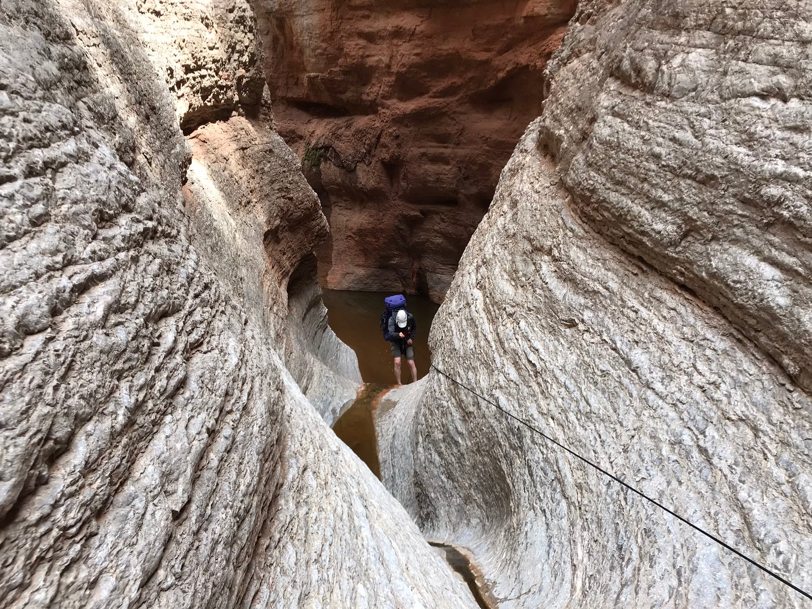
In the slicky-slide, I took my pants off to keep them dry since the water was thigh-deep. Once we were out, it was beautiful. Pretty trees in pretty lighting.

Relieved that the slicky-slide wasn’t that bad
We kept on down the canyon, our new goal was to camp at the Crazy Jug intersection, which would put us one full day behind. Fortunately, we had one rest day built in. But, we could spare no more. However, we first had one more bypass. Shimmy along the wall, then scramble down the loose slope.
Shimmy along the wall, then carefully scramble down the loose stuff
After some final boulder-hopping for the day, we reached the Crazy Jug intersection and set up camp.
Almost to the junction with Crazy Jug
Day 3
“May your adventures bring you closer together, even as they take you far away from home.” – Trenton Lee Stewart
The first half was walking down an off/on stream, heading west from Crazy Jug towards Tapeats creek.
Fine morning for boulder-hopping
Relatively easy, some boulder-hopping, and some surprise down climbs that weren’t too bad.
Most of the downclimbs were ok though the last one to the creek got my attention
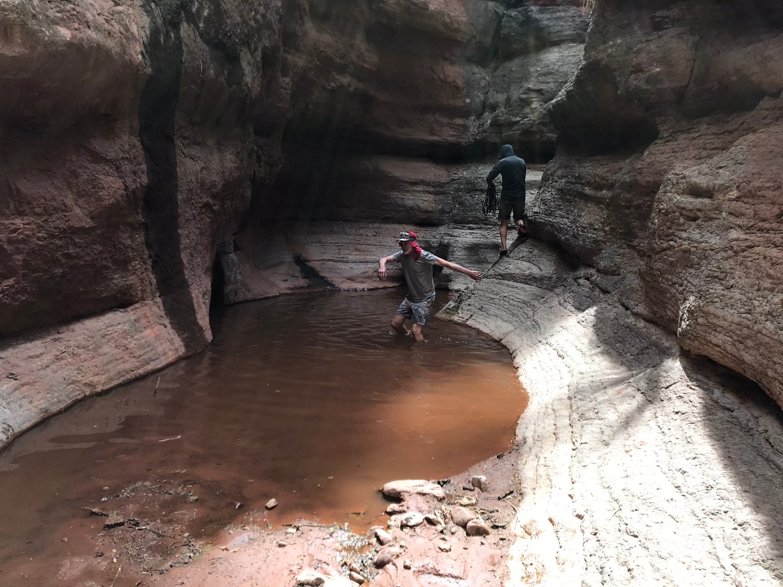
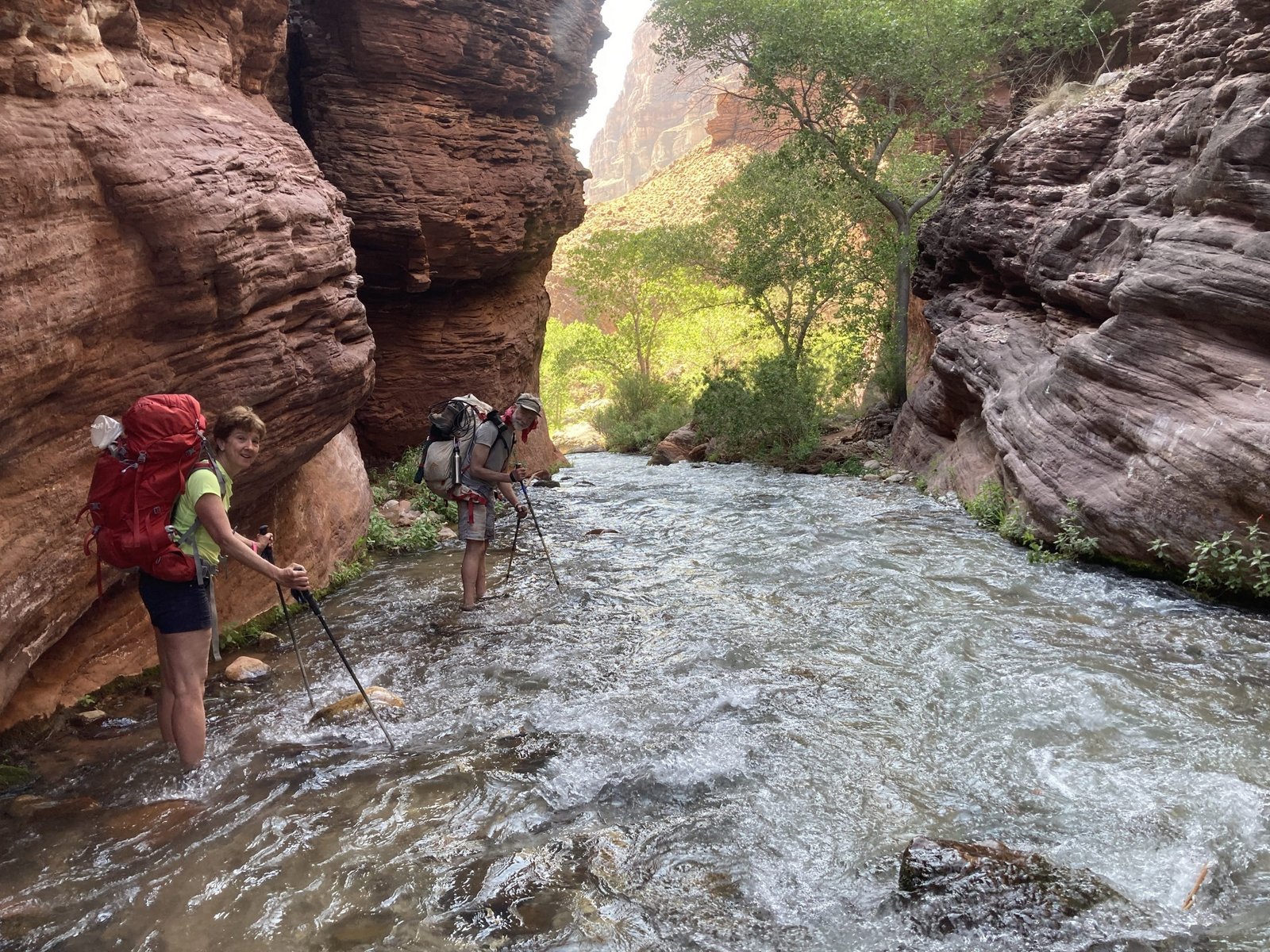
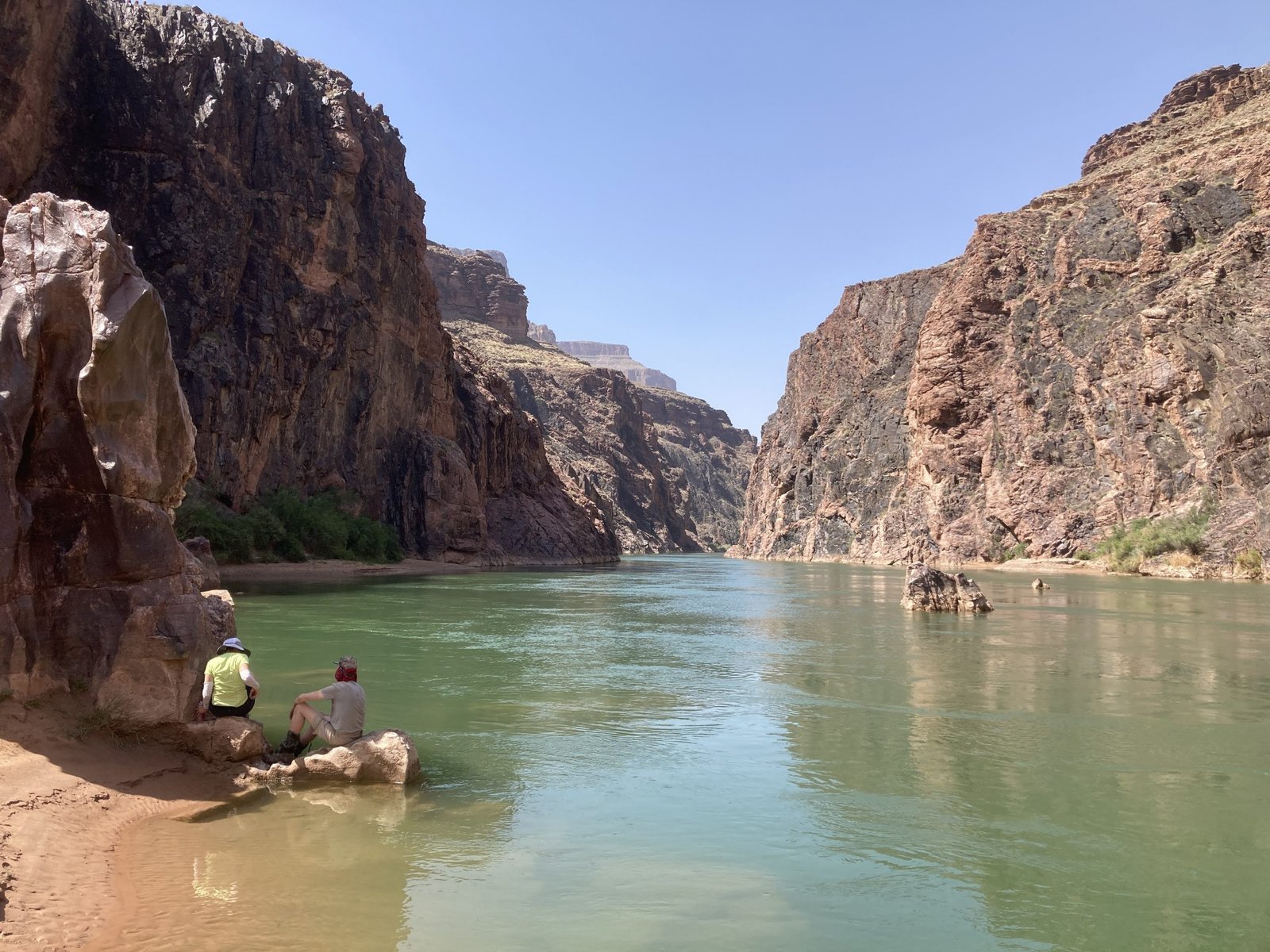
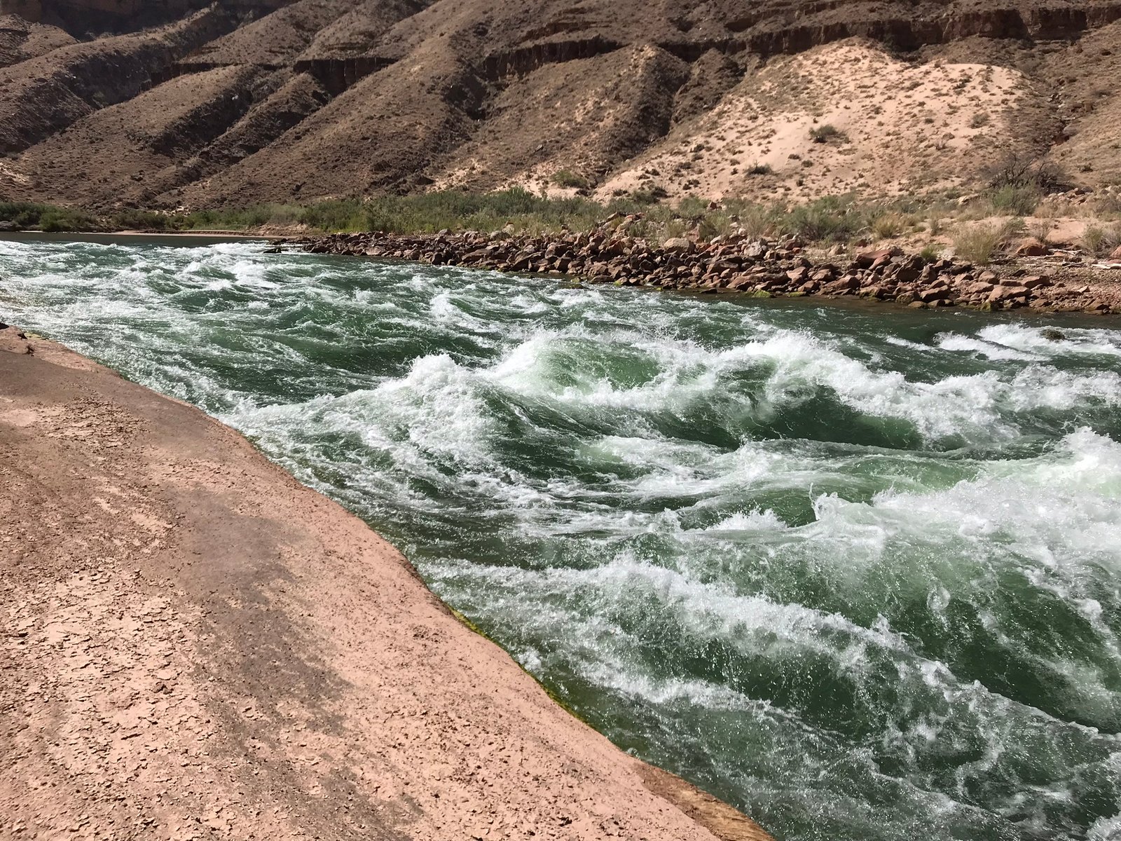
Next came to creek crossing and the narrows. Lots of talk about how scary this could be, especially in spring runoff. But, it wasn’t bad at all. Water was maybe up to our shins and once in a while knees.
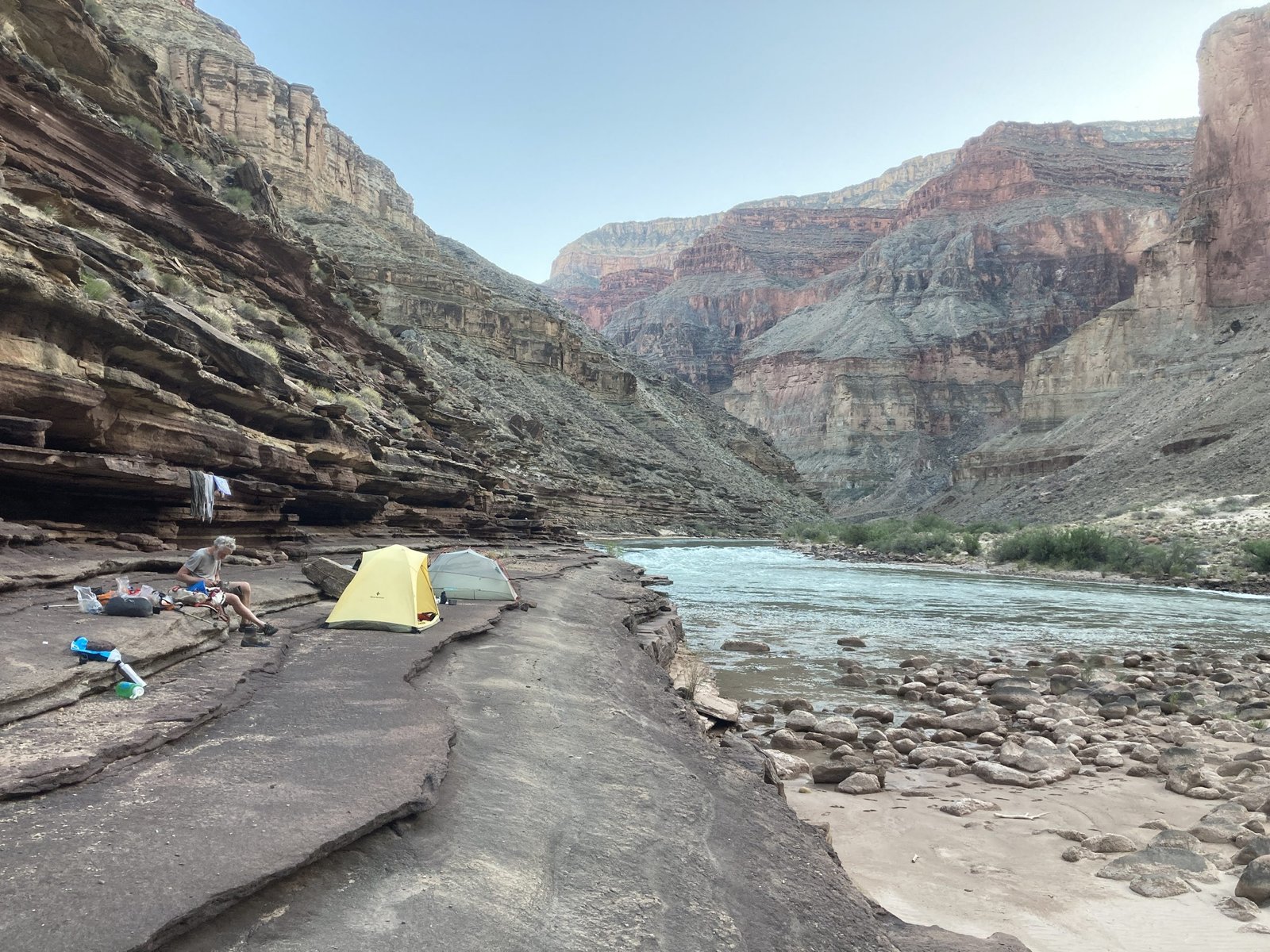
After a handful of crossings, we found a beautiful campsite along the creek and called it a night a little earlier than usual.
One of the two best campsites of 12
Day 4
“You’ll miss the best things if you keep your eyes shut.” -Dr. Seuss.
This day we finally had a trail for a while. The junction of Tapeats Creek with Thunder River is a popular spot for boaters and hikers. Thunder River is the shortest river in the U.S. and comes directly out of a cave in the rock high above. We didn’t take the extra time to hike up to it. Lenny and PK had been there before and actually took a raft (dangerously) deep into the cave!

Junction of Thunder River joining Tapeats Creek
We, instead, continued down Tapeats Creek and a mostly decent, but sometimes overgrown, trail.
Nice to have a trail though you had to watch out for cactii sometimes
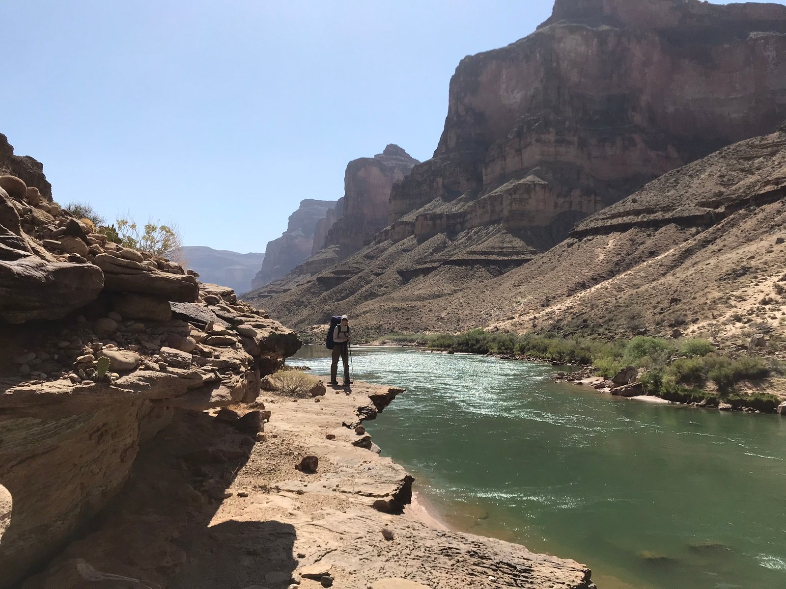
All was well until we departed from Tapeats Creek and headed southeast, up and over the hill to get to Stone Creek (tiny) and the Colorado River. Getting there was nerve-racking for those with fear of exposure (me). Tiny, one-shoe-wide, trail alongside a big dropoff.
Once past the exposure, the trail went along and over some “hills” to get to Stone Creek where we downclimbed on the east side to get to the floor. That was also a little scary for me (a sign of more to come).
Upon arriving at Stone Creek, we took some time to rehydrate but it was cut short when a group of noisy boaters went up stream to “shower.” We decided to press on to Galloway, the next canyon, for the night.
Day 5
“What’s fun for other people may not be fun for you and vice versa.” -Gretchen Rubin.
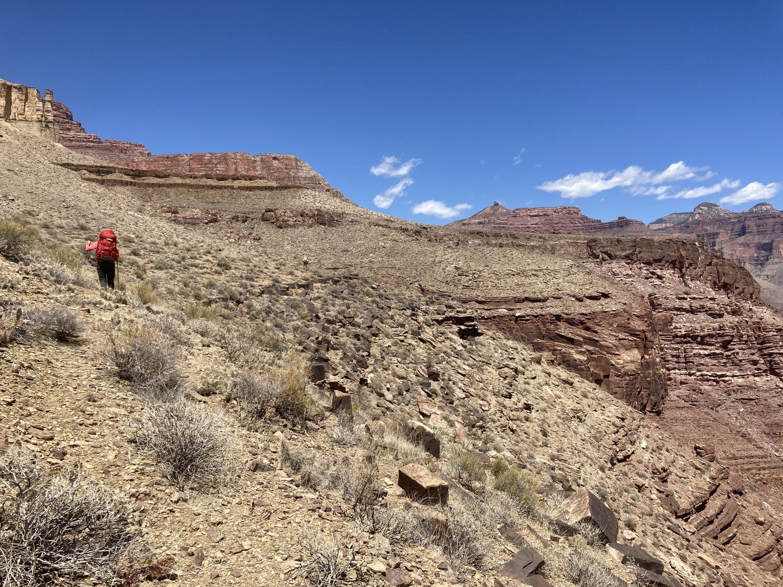
The next morning, we pressed on at the river level. Lots of boulder-hopping and bushwhacking again. Wearing shorts, thinking we were done bushwhacking, I got pretty scratched up. We took a nice break along the beach where there was some polished pink rock. It was pretty cool looking but it was also the place we had to climb up away from the river.
Last of the beach for a while
Pretty pink rock but it meant climbing up and out
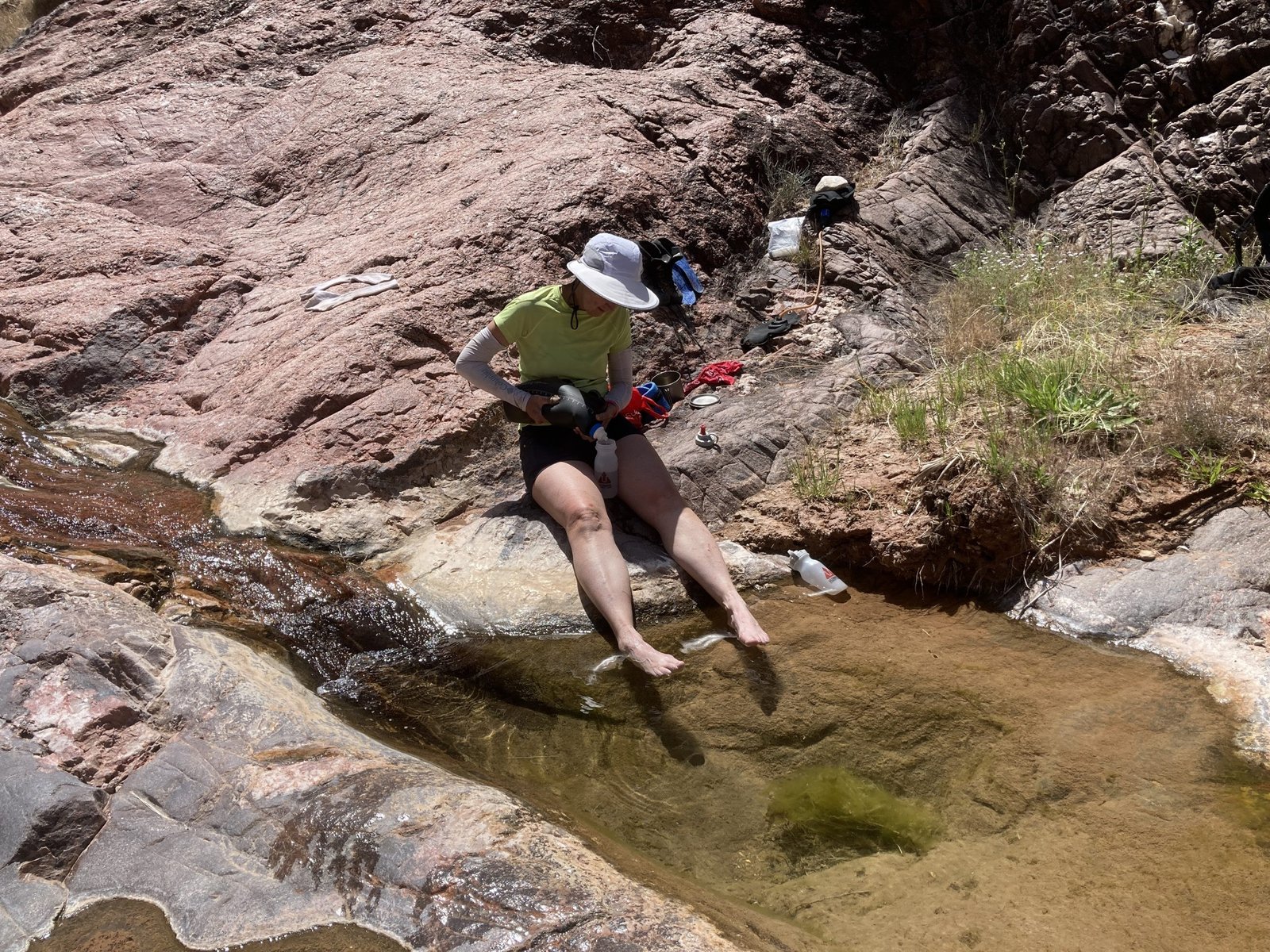
Canyon miles are a real thing and quite different from river miles. Trekking along rocky, slippery, and steep side hills, then in and out of side canyons takes time. We had a nice lunch spot in Bedrock Canyon where we enjoyed the clear pools and running water.
We made it to 128 Mile Canyon where we made camp for the night. While previous reports suggest there are no camp spots and the climb out is a steep chute opposite the climb in, we headed downstream a little and found some really nice, flat, sandy camp spots and a much gentler climb out for the next day. There was running water in the canyon but there were also salt crystals present, which may have meant magnesium in the water (think “milk of magnesia”).

Looking down on our campsite below

The canyon is rough on gear. PK’s frame breaks through his pack. Also, one of his shoes had lost its sole but he glued and tied it back on.
Day 6
“May your trails be crooked, winding, lonesome, dangerous, leading to the most amazing view, May your mountains rise into and above the clouds.” – Edward Abbey.
Another day and another climb out of the canyon. Again, we were traversing along side hills far above the Colorado River.
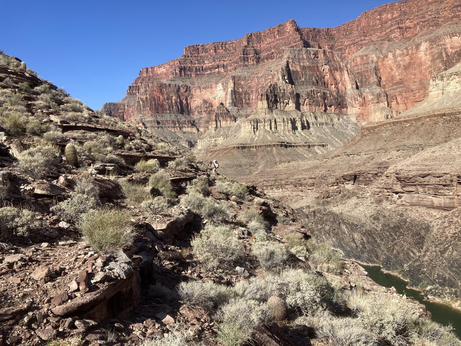
The loose rock and dropoff get to me every time
At some point, we had climbed up pretty high. In the canyon, the higher you go, the steeper it is. Soon, it felt quite treacherous and I could see a game trail far below. We made our way down and the travel went much faster. At one point, as we were making our way around the head of a super steep side canyon, shimmying and holding on to a boulder, a rattlesnake rattled from inside the boulder!
Over the course of the day, our goal was to get upriver to an area called Fossil Rapids. It was an extremely hot day and had been a while since we’d been near water.
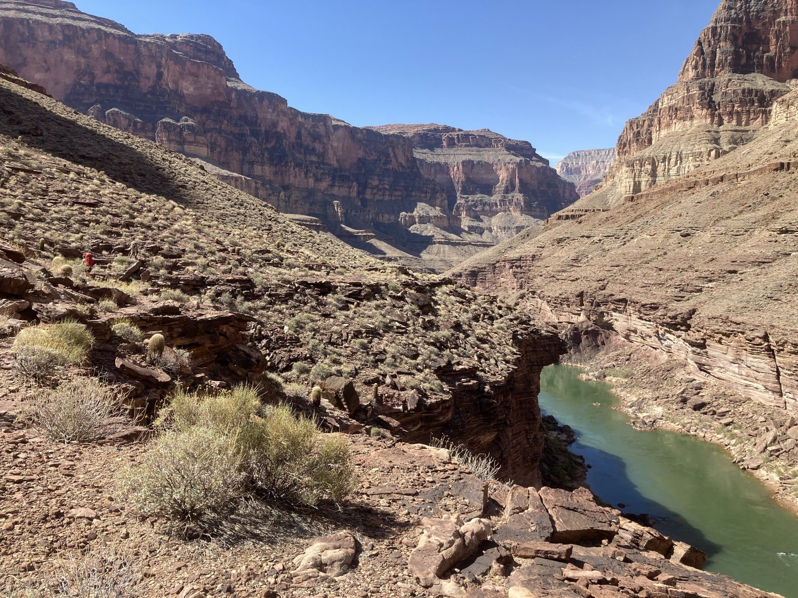
Around lunch time, we came to 127 Mile Canyon where prior reports mentioned going down the nose to the river. That looked insane, so we continued into the canyon, believing we could take the long (easier) way down.
We got quite a ways down into the canyon before we got stopped by a dryfall that was too high to pass. Our best way out was to keep going back up, then out, then up some more.
We did find puddle water to fill our bottles however.

Late in the afternoon, we made our way back down to the river at Fossil Rapids. Now this is the day I’d been waiting for. Beautiful Tapeats ledges are like sidewalks that run alongside the river. We made camp on one of those ledges.
Day 7
“There are some places so beautiful they can make a grown man break down and weep.” – Edward Abbey
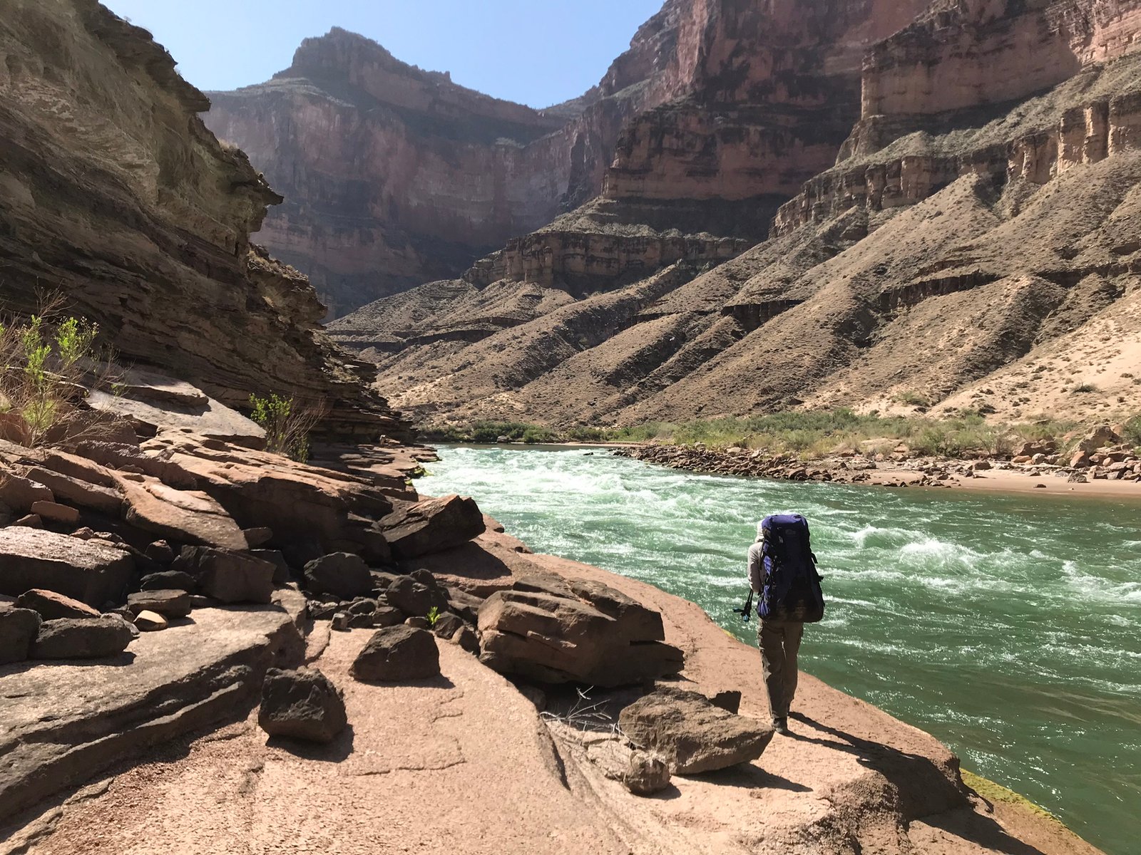
After a night of soaking in the river, drinking cold water, and generally relaxing, we set out and continued upriver. Initially, that meant more bushwhacking and boulder-hopping before arriving at Forster Rapids. Forster has a beautiful beach where we soaked our feet and filled our bottles. I wanted to stay there all day, but the clock was ticking and the sun was intensifying.
Forster beach
Moving along, we had a bit more “sidewalk” before having to climb out and up the hill. Pretty cool having the rapids running right beside your feet!
We spent about half the day along the river, which was so pleasant. Nice to always be so near to water. But, after Forster Rapids, we had to climb up and out. Just as the day was again heating up. Temps were in the mid-90s.
Later that afternoon, we climbed down the downriver nose of the Tapeats at Blacktail Canyon and would climb up the upriver nose to get out.
After getting down, we headed for shade inside the canyon
Blacktail Canyon is really cool! It was even cooler that a nice group of boaters from O.A.R.S. gave us each a cold soda. We soaked our feet in the river and then explored the short canyon.
The guides were in there telling us all about the geology and how to spot the “great unconformity.” One even had a guitar and Lenny played a song for them. They begged for more but we needed to set up camp and get dinner made. Tomorrow would be a long, hot, tough day.
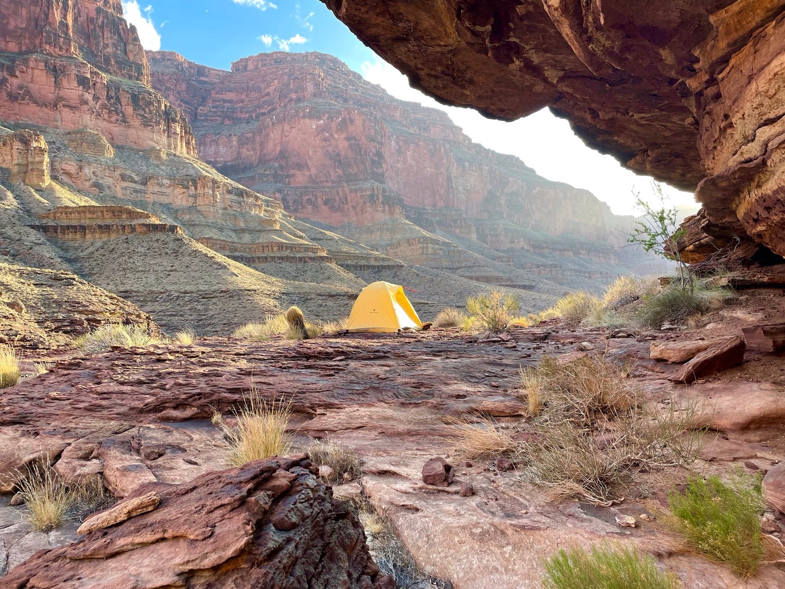
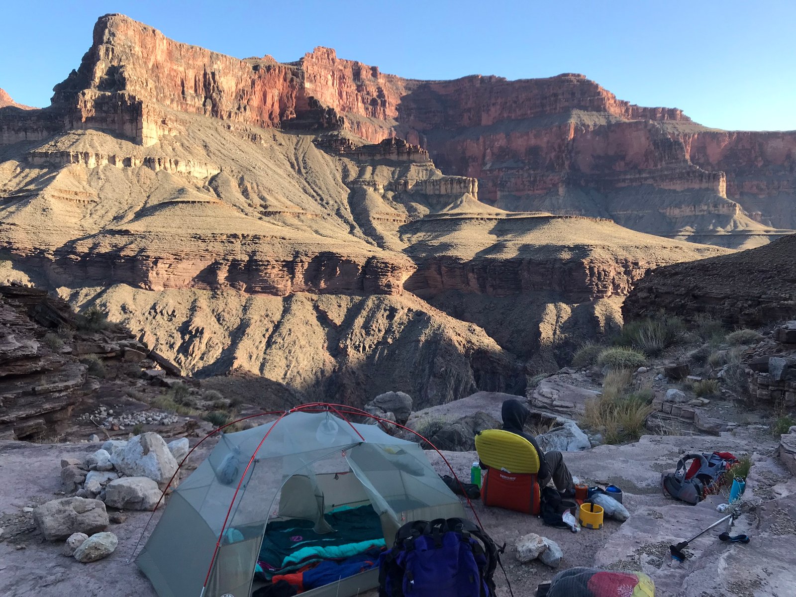
PK’s tent at our campsite above Blacktail
Day 8
“We have not journeyed all this way because we are made of sugar candy.” ― Winston S. Churchill
Welp! Here we go. The next few days have no reliable water sources. With temps in the 90s, there’s no way to cool off and getting enough water to drink could be an issue. The plan this day would be to go from Blacktail to what is called Key Spring, or even Grubb’s Canyon, if we could get there. But first, that mean a long, tough, rocky, messy traverse, crossing a steep and slippery fault at Explorer’s Monument, hoping for any bit of shade, and finishing the trek to Key Spring.
We set the alarm for 5am (which we would do for the rest of the trip) to try to beat the heat.
Yes it was steep and yes, my smile is fake
Going was slow. We looked for any small overhang or boulder to crouch in the shade. The fault in Explorer’s Monument was chaotic, steep, scary, hard, hot, and just overall tough. Even after we were past, the terrain was still challenging for a while.
Sometime after 6pm we stopped at Key Spring. This area was named Key Spring because at the time, it had water running, making it key to the trek. Though the water was reported to be high in magnesium. However, there was no water this time. It was all I could do to get in the tent and lay down.

PKs right boot won’t hold its sole anymore so he’s had to wear his sandal. Now, the left is is broken so it’s glued and tied!
Day 9
“A hero is an ordinary individual who finds the strength to persevere and endure in spite of overwhelming obstacles.” – Christopher Reeve
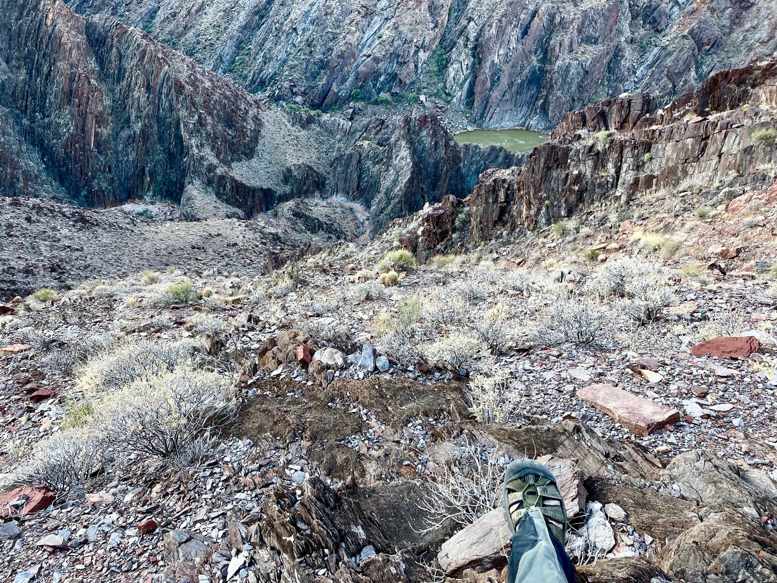
Back on our way. There was reported to be some potential water pools in Grubb’s Canyon, about an hour or so upriver. Lenny had mapped out a route to the river just in case, but that would have taken a good half-day to do and put us way behind. When we arrived, we couldn’t find any water…at first.
Can you spot us?
After scouting the canyon, we found a big pool of green water! Crazy how that can feel like such a relief when any other time you wouldn’t even think to get water from something like that.
Sooooo relieved!
After filtering once through a bandana to remove large bits, we filtered again using our filters. The result was water that was slightly green. I added drink mix to mine to try and hide the look and taste but was only moderately successful. On our way we went.

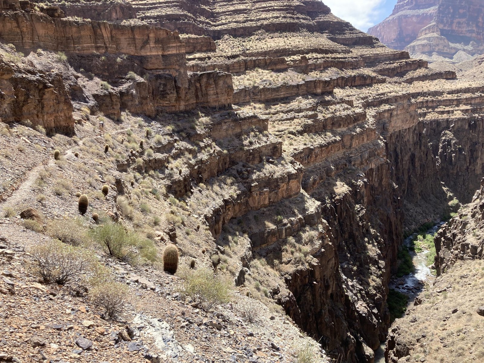
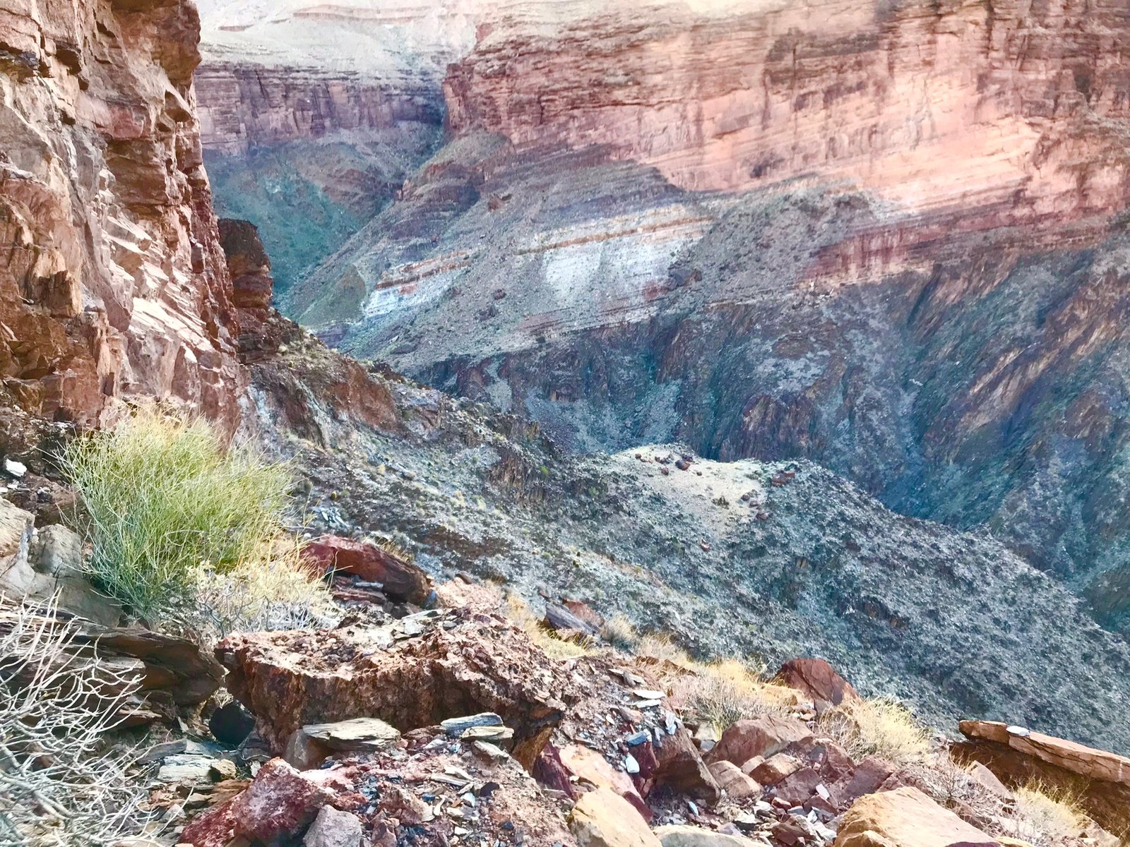
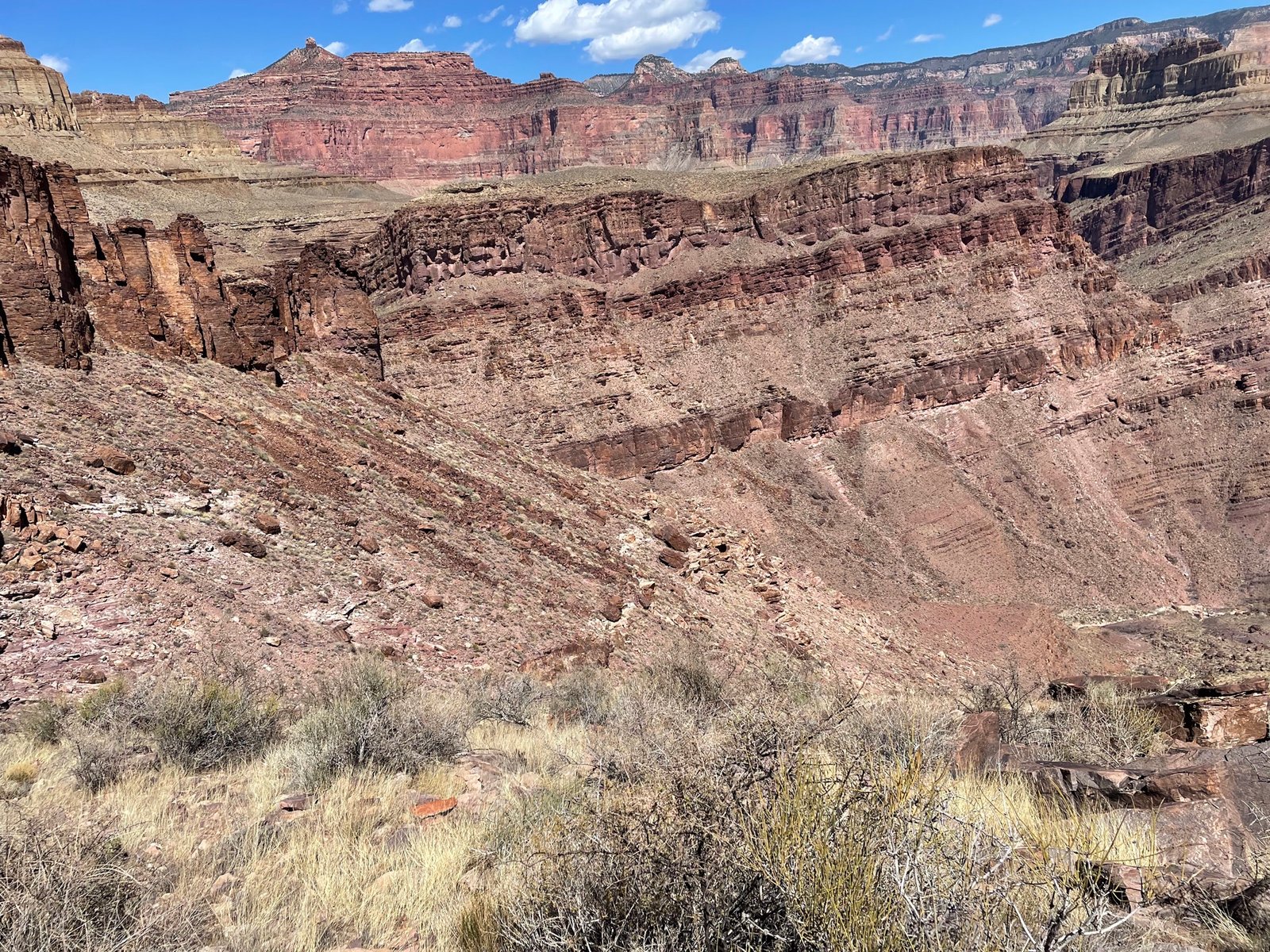
Walthenberg is a HUGE canyon. It’s reported to be 3 hours from one side to another, but that’s if you’re sure where you’re going. I think it took us 5. In this last pic, you can see both sides and how challenging it was. Once again, we were hot and exhausted and still had a ways to go for the day.
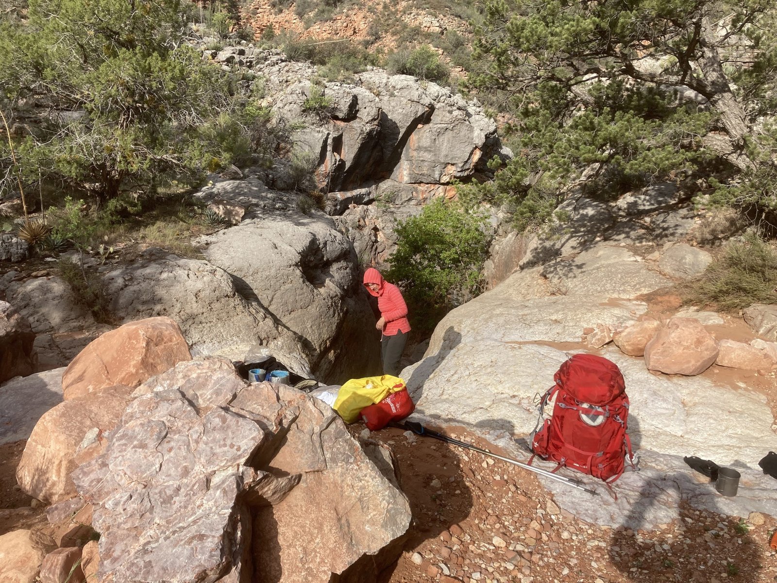
We made it as far as the entrance to Hakatai Canyon and called it a night. Found a beautiful ledge to set up camp though but knew the next couple days would be challenging physically and emotionally. Good thing I had no idea just how much.
Lenny making dinner with a view

Both of PK’s boots have given up!
Day 10
“Then I realized that to be more alive, I had to be less afraid. So I did it. I lost my fear and gained my whole life.” – Anonymous
Here we go. The dreaded Hakatai. Difficult in and difficult out. We worked our way to the downriver nose of the canyon which wasn’t so bad, but then had to cross the most steep, loose, and scary face to get in and down! 2,000 ft drop if you slid.
Had to cross this and the next ridge
It took quite a while to find a workable route in and down and, quite a while to get me down it. I’m guessing it took a couple hours, fears, tears, calming breaths, etc.
Part way across and the view is terrifying
Finally, we were down in the bed of Hakatai. Lenny had also mapped a route to the river here in case we needed water (which we did). The famous Harvey Butchart described getting to the river here but it didn’t sound very easy. I imagined another potential half-day lost.
After scouting downstream a bit, we actually found running water. However, it tasted seriously metallic and hopefully not asbestos-laden as there had been asbestos mining in the past by William Bass. I found it hard to drink and only sipped small amounts.
The climb out of Hakatai starts off easy enough but gets continually steeper and steeper. Many times we had to climb up things and a couple times I needed a rope for safety.

Climbing the many obstacles out of Hakatai

The climb out probably took an hour and a half. Most of the time it was just hard work. The scariest part was transitioning out of the canyon and on to the side hill. Once on solid and mostly level ground, the going was relatively easy again.
Cactii got closer and closer together – watch your step!
Our next challenge was Burro Canyon. Per the research, the entrance was similar to Hakatai, but less challenging. Interesting what some people determine as challenging though.
Although we saw what was reported to be the entrance, the route Lenny had so carefully mapped on the GPS didn’t jive. We followed the GPS to our detriment. To this day, we can’t figure out what happened.
We ended up too far up Burro Canyon and getting down the steep side hill and ravine took at least two hours. At any one time, you feel as though you may slip and end up at the bottom. Each step must be carefully placed.
By the time we finally got to the bottom, it was getting dark and we knew it wouldn’t be wise to continue – even though we were nearly out of water again. We made camp at the bottom of Burro and the guys scouted for water. What they found was a green, frothy, foamy puddle. Even after filtering twice, the water was still bright green. Back flushing the filters was a bit comical.
Once again, the water was awful and hard to drink. Lenny scouted how to get back on the correct route and found it. We couldn’t continue down Burro due to a pour-off, so we had to go back up and around.
Day 11
“If happiness is the goal – and it should be, then adventures should be top priority.” – Richard Branson
Once again, the alarm went off at 5am and we packed up. To reach the correct route, we had to climb halfway back up the hill, over some scree slopes and to the top of the gully where there had a been a boulder rockfall. Climbing down these boulders was frightening. Some were loose. Then getting down the steep gully was a challenge till we were almost all the way down.
Research had reported one final challenge. Notes said we needed to climb high on a ridge then down a steep and loose hill. Careful footing would be in order. However, our maps said differently. We continued down Burro Canyon until it met up with Shinumo Creek.
This is what heaven looks like
We had reached paradise! We weren’t going to die after all! We spent over an hour just soaking, cooling, washing, and drinking. It was as if the water washed all of our anxieties away. Words just cannot describe it. The rest of the day and the next had real trails and most of that was known to Lenny and I.
Now it was just a beautiful walk, 18 miles and 5,500 feet of gain to the trailhead. Fortunately, we had two days left to do this.
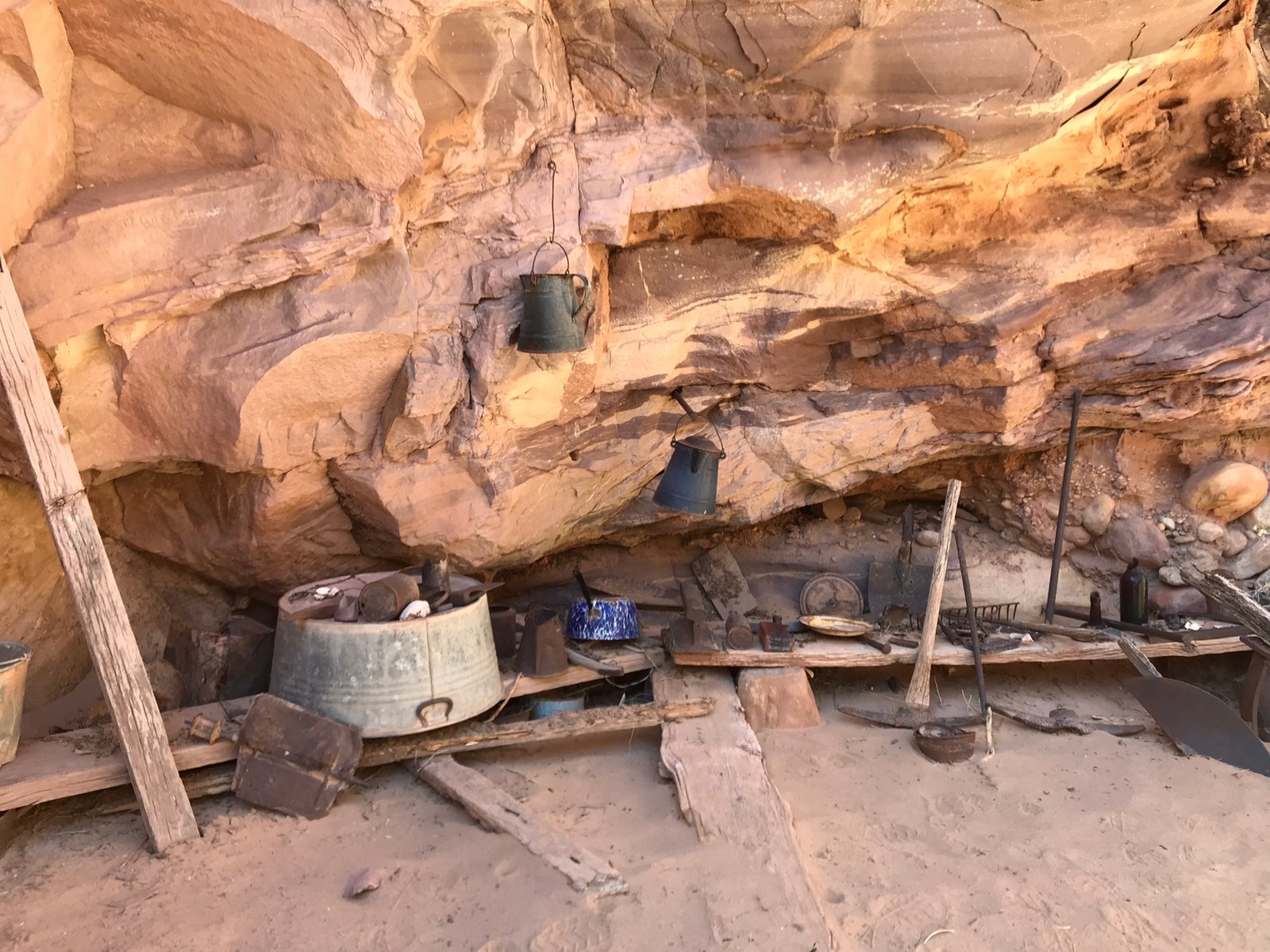
William W. Bass camp with tools still intact
Up Shinumo Creek we went. Crossing the creek several times and splashing whenever we could. At about 3+miles up, we turned off into the White Creek canyon and Tapeats Narrows. The trickle of creek came and went but the narrows were very pretty!
Once out of the narrows, it was again very HOT and dry. We walked up the dry wash for several miles before turning off onto a bypass trail and ending our day at some fun ledges. Several frogs gave us quite the concert!
Day 12
“There must be a beginning of any great matter, but the continuing unto the end until it be thoroughly finished yields the true glory.” – Francis Drake
Final day. Really? All I want is a hot shower and a cold diet coke. Just get me to the top. Last fall, we got to the top relatively quickly. Not so much this time. It was another HOT day and the going was slow. More bushwhacking than I remember. Nice to have a trail for most of the time though.
Sometimes PK would hike ahead but we met up at what is called Queen Anne springs. Since he liked going ahead, we suggested he take the car keys, drop his pack at the trailhead, hike the 6 miles and bring the car back to the trailhead. Lenny and I stayed at the spring for quite a while, filtering water and cooling off. We finally trudged ahead for the last HOT mile.
Even at the higher altitude, it was scorching hot
Oh no! Why is PK just sitting at the trailhead?! Turns out that they never did clear the road. It’s now 5:30pm and we still have 6 hot miles to go. And, the biting flies chased us all the way to the car.
6 more miles to go – sigh
Finally seeing the car was quite a relief! I fell into the seat, changed most of my clothes and shoes, and then noticed a big crack in the windshield! We had a rock hit the car on the drive in but it didn’t seem to do anything. Guess in the cold overnights, it cracked. Then, driving out, the low oil light came on. Last time that happened, I was told there was no oil in the engine! Hoping we could make the 60+ mile drive on dirt roads back to civilization. We left around 9pm.
But, the canyon wasn’t done with us yet! At around 10:30, we got a flat tire, on a dirt road, in the middle of nowhere. The guys jumped out and changed it pretty quickly and we all limped into town around midnight. Stopped at the gas station for some real food – a diet coke and a yogurt, grabbed a hotel room, showered, and crashed.
Seriously? What else?!

The next morning, we stopped at an auto shop to have the tire patched and oil situation addressed for the 9 hour drive home. Turns out whatever punctured the tire, did quite the number and they couldn’t patch it. They also didn’t have a replacement tire. So, four new tires and an oil change later ($850) we were on our way home.
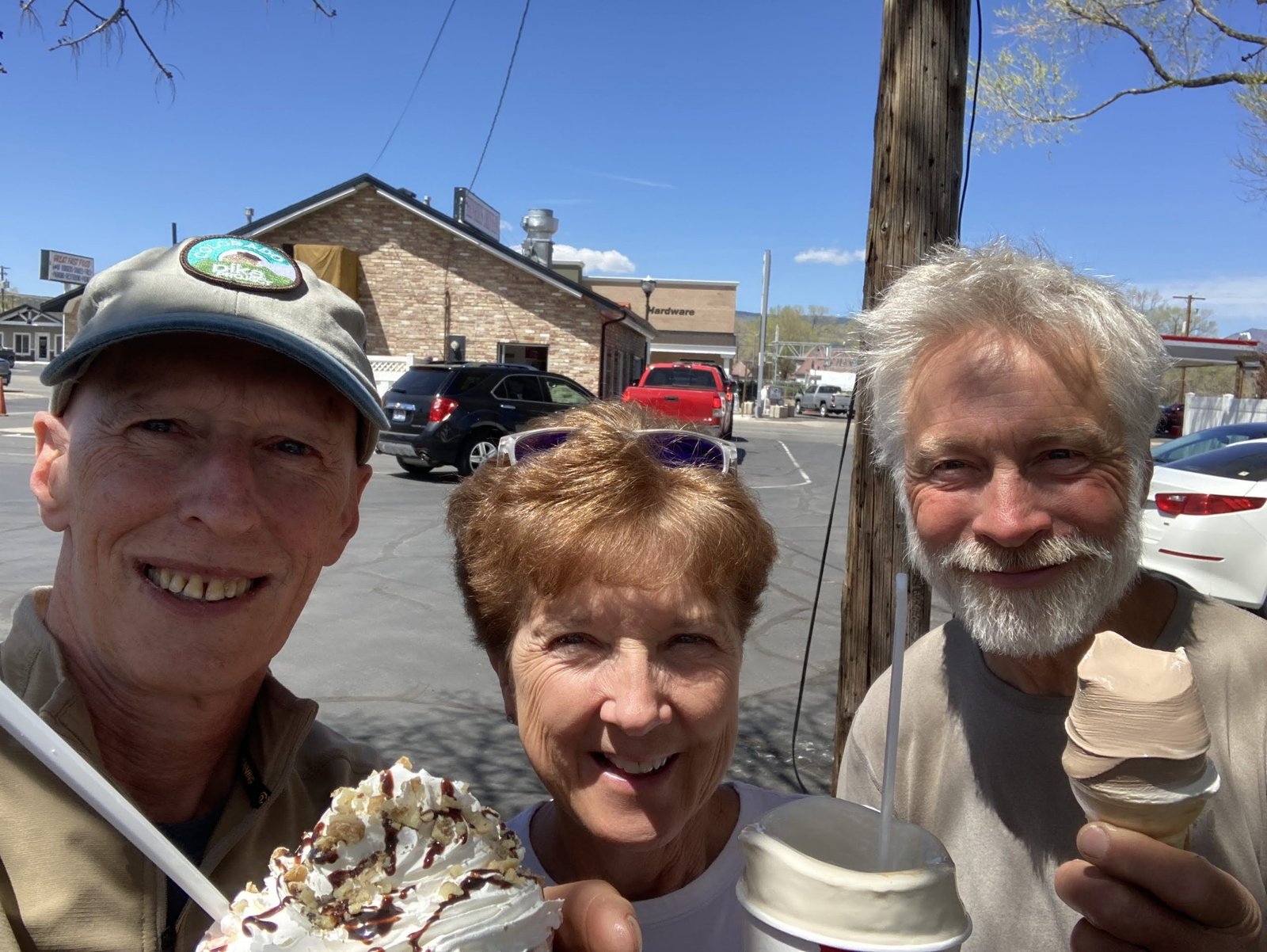
Stopped in Panguitch, UT at Henri’s for ice cream
“You cannot see the Grand Canyon in one view, as if it were a changeless spectacle from which a curtain might be lifted, but to see it, you have to toil from month to month through its labyrinths.” – John Wesley Powell
The End
#goplayoutside
#dosomethingepic